News
Stay tuned for the latest news of events, product release, features, updates, tips and more.


Date: 2024-07-15 3822
We’re excited to announce that the recently released version 9.1.3 of Spatial Manager is now available with GstarCAD 2025. Users of Spatial Manager for GstarCAD will get huge advantages of accessing tools in Spatial Manager and the latest technology from GstarCAD.
Spatial Manager for GstarCAD -- a powerful plug-in to manage spatial data
Spatial Manager for GstarCAD is a powerful and lightweight plugin designed for GstarCAD users. It runs inside GstarCAD and helps users import, export, and manage spatial data in a simple, efficient and affordable way. And the newest version includes many key enhancements and new features.
Key features and enhancements
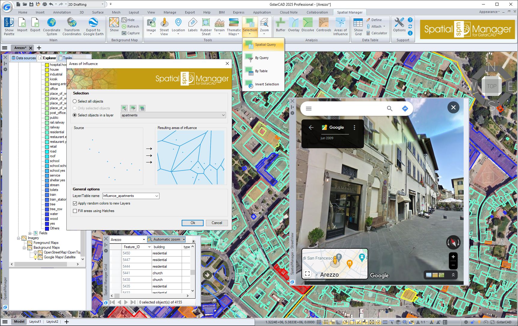
With Spatial Manager 9 for GstarCAD 2025, users can not only import/export spatial data into/from GstarCAD, but also experience advanced tools to manage spatial data, such as Thematic maps, Data grid, Fields calculator, spatial analysis, location tools, Google Street View integration, Label objects, terrain wizard, etc
Enhanced coordinates transformation
Spatial Manger for GstarCAD will calculate geometric transformations of the objects during the import/export process, depending on the chosen Coordinate System (CRS) for the source and target data.
![]()
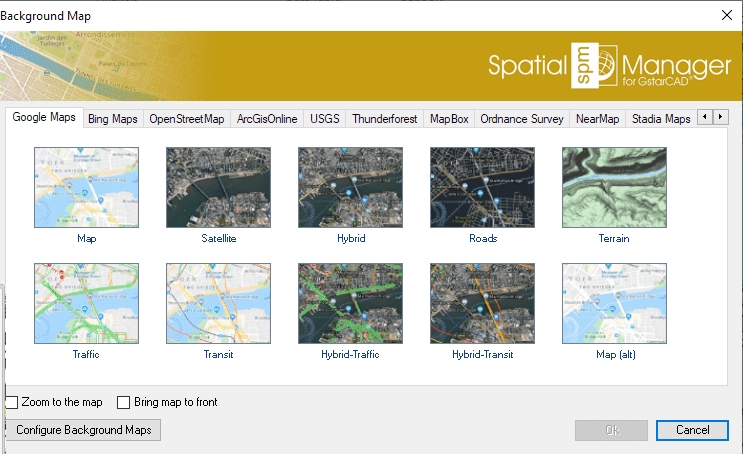
Enhanced background maps
Users can choose from a wide range of dynamic Background maps from providers such as Google Maps, OpenStreetMap, Bing, etc. and other customized maps. With the new version, users can display several background maps simultaneously.
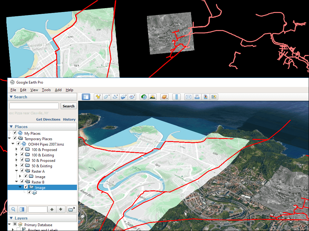
Google Earth publication
Spatial Manage for GstarCAD includes a specific command designed to Export all or part of the objects in the visible Layers of the drawing and their data, to a KML or KMZ file (Google Earth) in one click
What’s New?
Drawing tools
Drawing tools in Spatial Manager for GstarCAD 2025 allows users to perform actions directly on the drawing, such as Zoom objects, Invert selection.
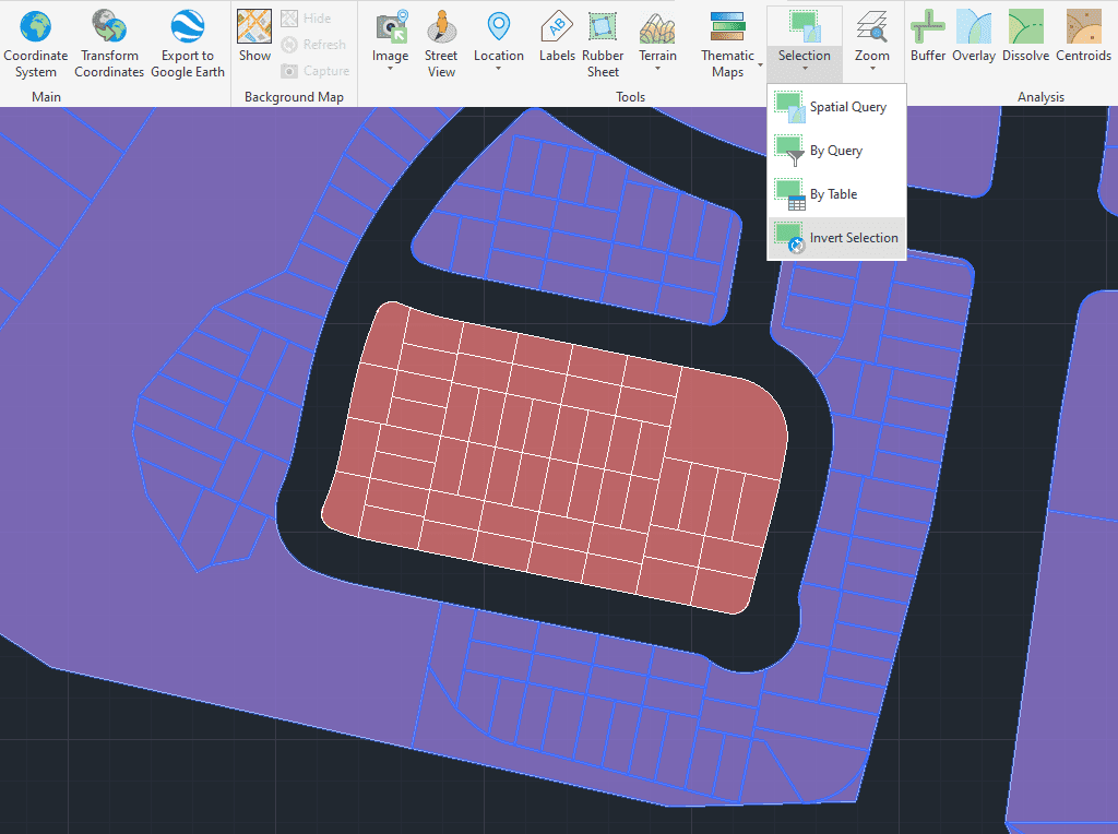
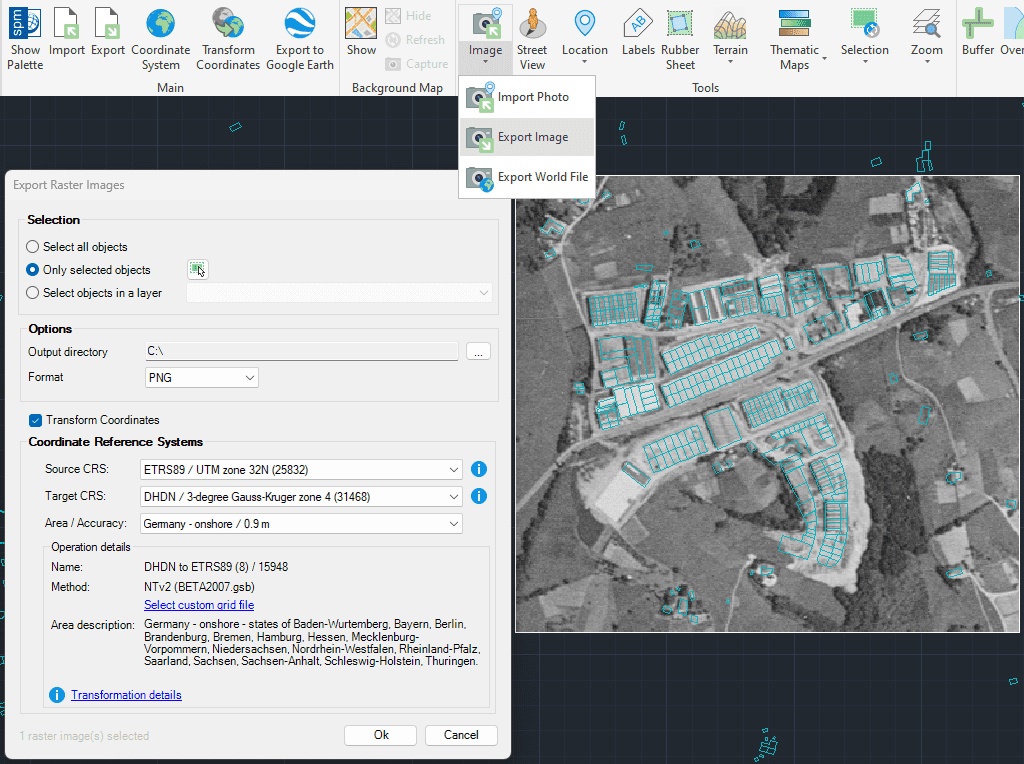
Image tool
Spatial Manager for GstarCAD allows users to manage raster images efficiently. Users are able to import/export raster images, generate georeferenced files of the images and load photographs by locating them on the map with the GPS information in them.
Spatial Manager for GstarCAD allows the user to import and export geospatial data between GstarCAD drawings and geospatial files, data servers or data stores, display background maps, manage alphanumeric data and data systems, and many more geospatial functionalities.
Download and explore more
Spatial Manager 9 for GstarCAD 2025 is now available for download, please feel free to download and try out
https://www.gstarcad.net/application/spatial-manager-for-gstarcad?id=35

2025-10-14
2025-07-10

2025-04-23

2025-04-17

2025-04-11

2025-04-03
2025-03-31

2025-03-12
