Application
We cooperate with local developers to provide industrial solutions for customers.
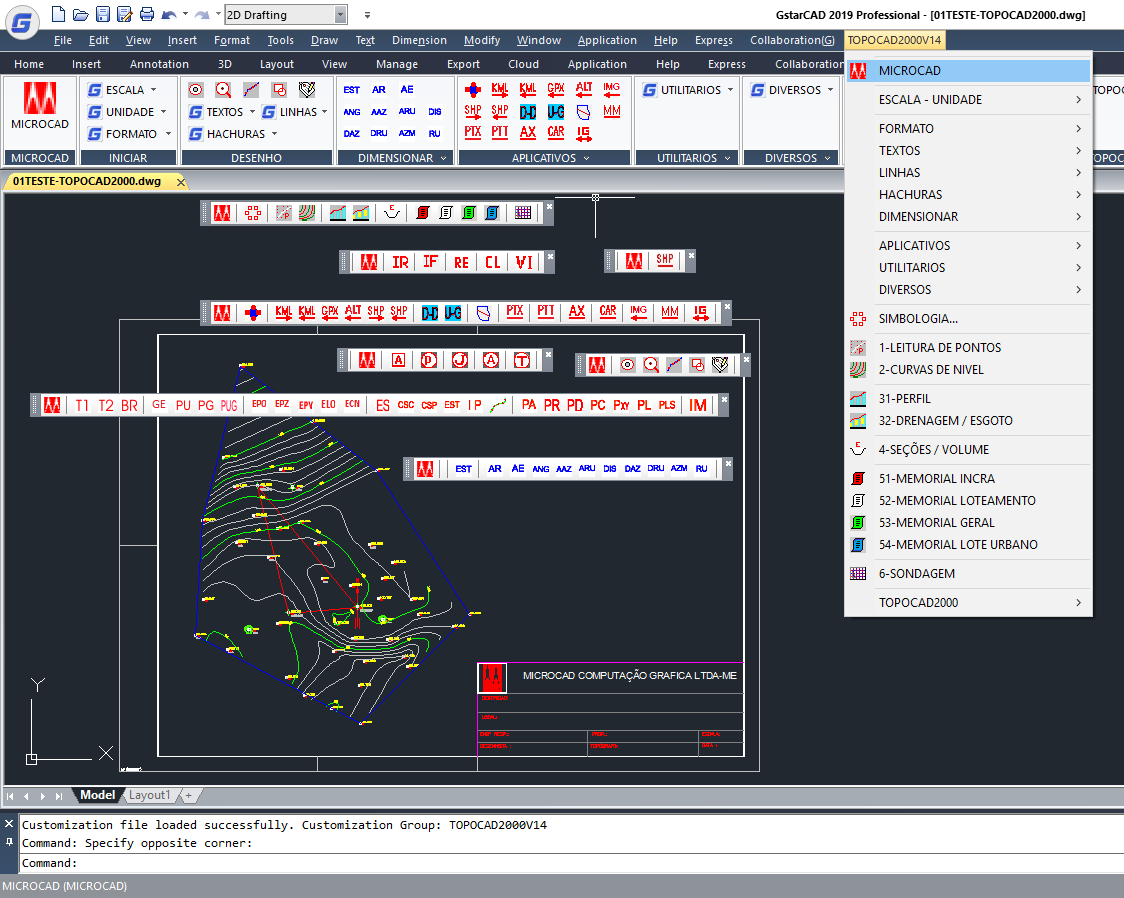
This system was developed to be used in the CAD environment offering facilities for topographic drawings:
-IMPORT OF POINTS-topographic points can be calculated and/or imported from a dialog in AutoCAD itself or from Total Station (LEICA, TOPCON, PENTAX...) or GPS. LEVEL CURVES-from the imported or manually inserted points, you can create level curves quickly and easily by simply triggering a menu button.
-PROFILE, GREIDE and DRAINAGE-performs the grid design with horizontal and vertical scales of the profile, Greide and the main and secondary drainages for roads, rivers, railways, etc.
-CROSS SECTIONS, AREA and VOLUME CALCULATIONS-Performs the sections design Transversal with automatic calculation of areas and volume.
-DESCRIPTIVE MEMORIAL-Performs the descriptive Memorial, analytical calculus and stamp inserts, all according to INCRA according to law 10267 3 ª. Editing/General pattern-PROBING-Performs the report for percussion polls.
-Calculation of optimized areas and dimensionings with table generation.
-Export to Shape-layers and KML files for CAR.
-Exporting KML files.
-Importing KML/GPX/SHP files.
-Importing images from Google Earth "online".
-TALUDE-Performs the Slope drawing with the indication of a line.
-BARRANCO-Performs the design of ravine with the indication of a line and distances.
-GRID-Performs georeferated coordinate grid design.
-Symbology of topography for manual insertion.
-Change of scale for symbology and texts.
-Definition of work unit (m, mm and cm).
-Definition of working scale.
-Insertion of formats and stamping adjusted the unit and scale.
-Standardized filling of stamping.
-Standardized text heights.
-Easy access non-continuous lines and automatic adjustment for drawing scale.
-Stylised and automatically adjusted sizing.
